

First ever hay fever map of Britain to put an end to runny noses by highlighting pollen hot spots

SCIENTISTS have developed the first ever hay fever map of Britain in a bid to help sufferers find relief from runny noses, sneezing and itchy eyes.
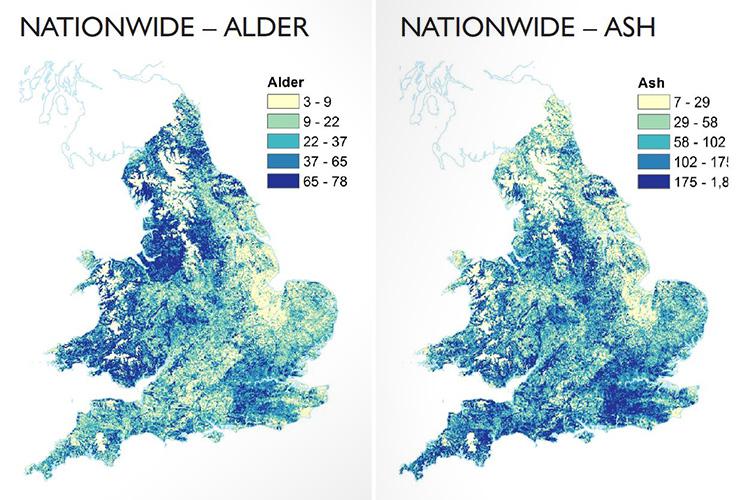
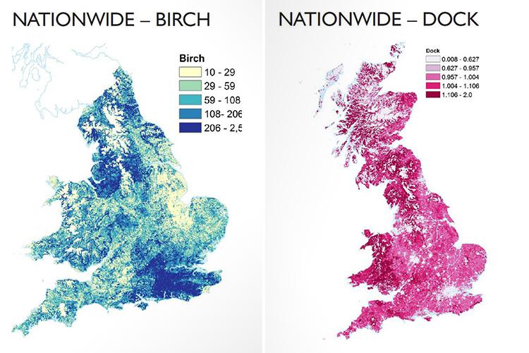
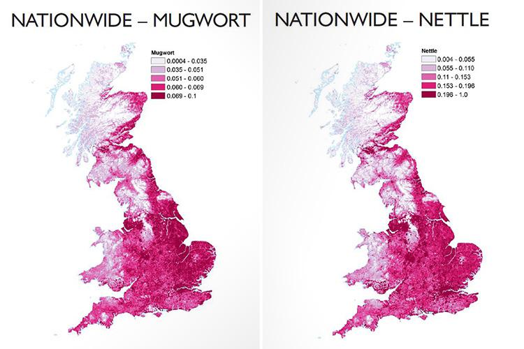
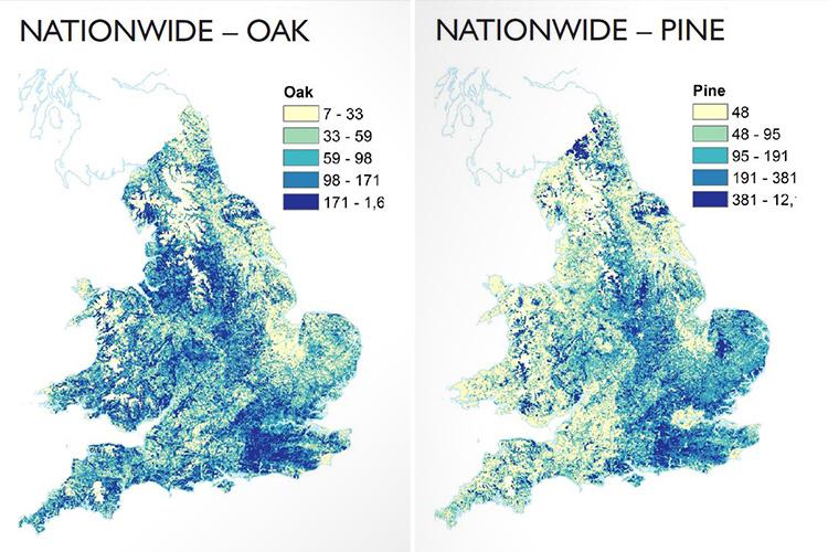
The colourful atlas details the location of 12 plants and trees known to produce pollen that triggers allergies and asthma.
It may help people decide where to live or which areas to avoid at high season.
The maps – produced by the University of Exeter and the Met Office – feature the most potent offenders, including grass, birch, alder, oak and nettle.
They show a higher percentage of allergenic grass in the northern and western regions of Britain.
The eastern central area has the lowest.
Up to three in ten adults and four in ten children suffer from hay fever.
The allergy is usually worse between late March and September, when the pollen count is at its highest.
MOST READ IN HEALTH


The boffins developed the maps as part of a study examining the effects of pollen on hospital admissions for asthma between 2005 and 2011.
They found there was a spike in admissions four to five days after grass pollen counts surged and two to five days after the Met Office issued “very high” pollen alerts.
Around 80 per cent of people with asthma also have a pollen allergy and in the UK and around 10 per cent of the adult population is affected by asthma.

Dr Rachel McInnes, from the Met Office, said: “These maps are a step towards a species-level pollen forecast.
“Pollen can have a serious impact on the well-being of those with hay fever or asthma.
“By working towards a localised, species-level forecast, vulnerable people can better plan their activities and manage their condition.
“These new maps could also provide local authorities and healthcare practitioners with information to assist patients with pollen allergies.
“While these allergenic plant and tree maps do not provide a forecast of pollen levels, they do provide the most likely locations of grass and of tree species which are the source of most allergenic pollen.”
Researchers suggest combining the maps with pollen forecasts and a diary may help people better manage their condition and learn which hotspots to avoid.
Dr Nicholas Osborne, from the University of Exeter, said: “We hope that these maps will contribute to ongoing research that aims to better determine when plants pollenate.
“That will allow us, with time, to provide better warning to allergy and asthma sufferers to enable them to better manage their disease.
“In the future, more people will know what species they are allergic to.”
The maps are published in the journal Science of the Total Environment.
We pay for your stories! Do you have a story for The Sun Online news team? Email us at tips@the-sun.co.uk or call 0207 782 4368


