
FLOODY HELL
Met Office issues ANOTHER warning with schools forced to close next week as floods & thunderstorms wreak havoc across UK
Find out the forecast for the next few days below

THE Met Office has issued further severe weather warnings with schools forced to close as floods and thunderstorms wreak havoc.
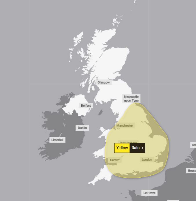
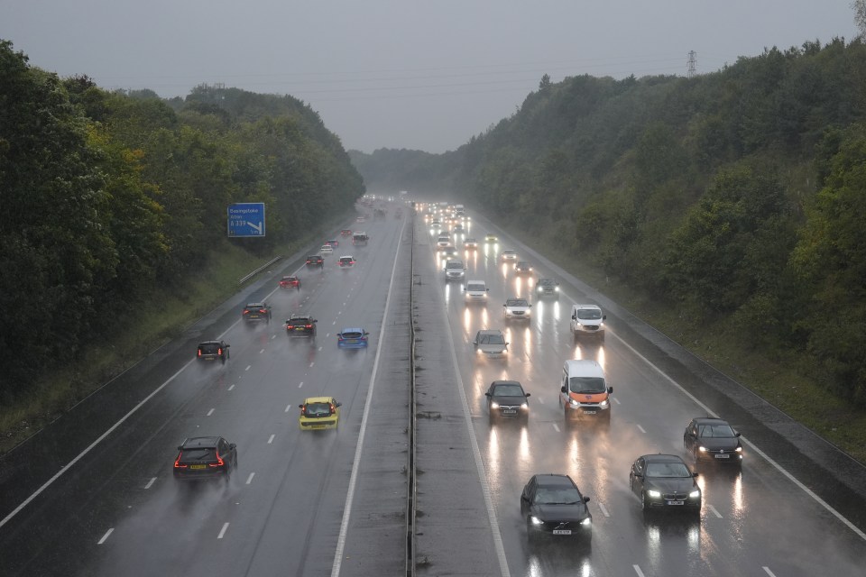
Two fresh yellow rain alerts are now in place until midnight on Monday meaning at least a further 48 hours of downpours across large swathes of England.


A thunderstorm warning remains in place until midnight tonight in the South.
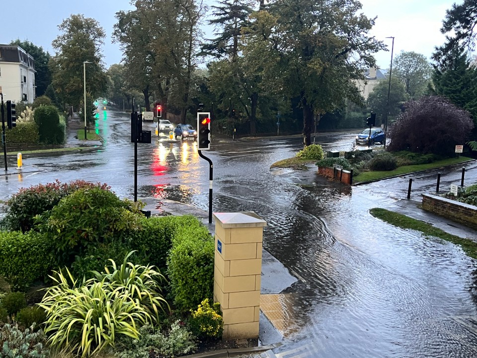
It comes as leisure centres, a recycling plant and a school were forced to close in Gloucestershire due to "significant" flood damage, according to the fire and rescue service.
Chosen Hill School in Churchdown will be closed on Monday, while two leisure centres in Cheltenham remained shut on Saturday.
Have you been severely affected by the bad weather? Email [email protected]
Cheltenham General Hospital also reported water coming through the ceiling.
Friday night and early Saturday morning saw thousands of lightning strikes, while heavy rain caused flash flooding.
Some areas were forecast to see between 50mm and 70mm of rainfall over a few hours, accompanied by hail and frequent lightning.
The first new rain warning could result in power cuts, covering much of South West England and Wales, as well as the Midlands.
The second covers a much broader area, from the south coast up to Tyneside in the North East, while also taking in parts of Wales.
It is likely to cause "some disruption" on Monday, the Met Office says.
Forecaster Dan Harris said the wet weather is expected to continue into next week.
He said: "We are expecting the area of persistent and at times heavy rain to have developed by the end of Sunday.
"It will most likely continue for some parts of southern UK through at least the first part of Monday, before starting to clear eastwards.
"By this time, however, confidence falls sharply in terms of both its exact location and rainfall amounts."
On Friday howling winds swept through the Hampshire town of Aldershot - damaging homes and trees.
Firefighters were scrambled after a column of air moved 1.2 miles through the town just after noon.
Footage showed the winds ripping tiles off roofs and blowing them across the street.
But no one was injured by the fast winds, a spokesperson for the local council said.


Saturday evening:
Showers easing for a time with clear spells, though staying cloudy with mist patches in the northeast. Further heavy, thundery rain moves into the south through the early hours.
Sunday:
Heavy outbreaks of rain move northwards through the morning across southern England and much of Wales, turning thundery at times. Drier in the north with sunnier spells in the west.
Monday to Wednesday:
Heavy rain likely across central parts of England on Monday with brighter spells for some. Calmer on Tuesday a few showers possible. More widely wet and windy from mid-week.


